Germany
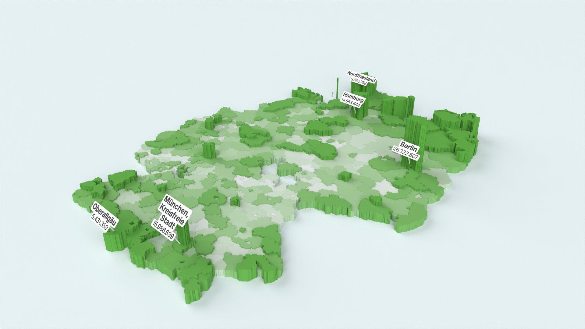
Germany has the most comprehensive region coverage in Hydrant, with NUTS regions, city-level schemes for Berlin, Hamburg, Munich, and Cologne, electoral districts, and historical divisions.
| Scheme | Levels | Source |
|---|---|---|
| NUTS Regions | NUTS-1, NUTS-2, NUTS-3 | Eurostat |
| Berlin Bezirke | Bezirke (12) | Geoportal Berlin |
| Berlin Ortsteile | Ortsteile (97) | OpenStreetMap |
| Berlin Planungsräume | Planungsräume (542) | Geoportal Berlin |
| Hamburg Bezirke | Bezirke (7) | OpenStreetMap |
| Munich Stadtbezirke | Stadtbezirke (25) | OpenStreetMap |
| Cologne Stadtbezirke | Stadtbezirke (9) | OpenStreetMap |
| Bundestagswahlkreise | Wahlkreise (299) | Bundeswahlleiter |
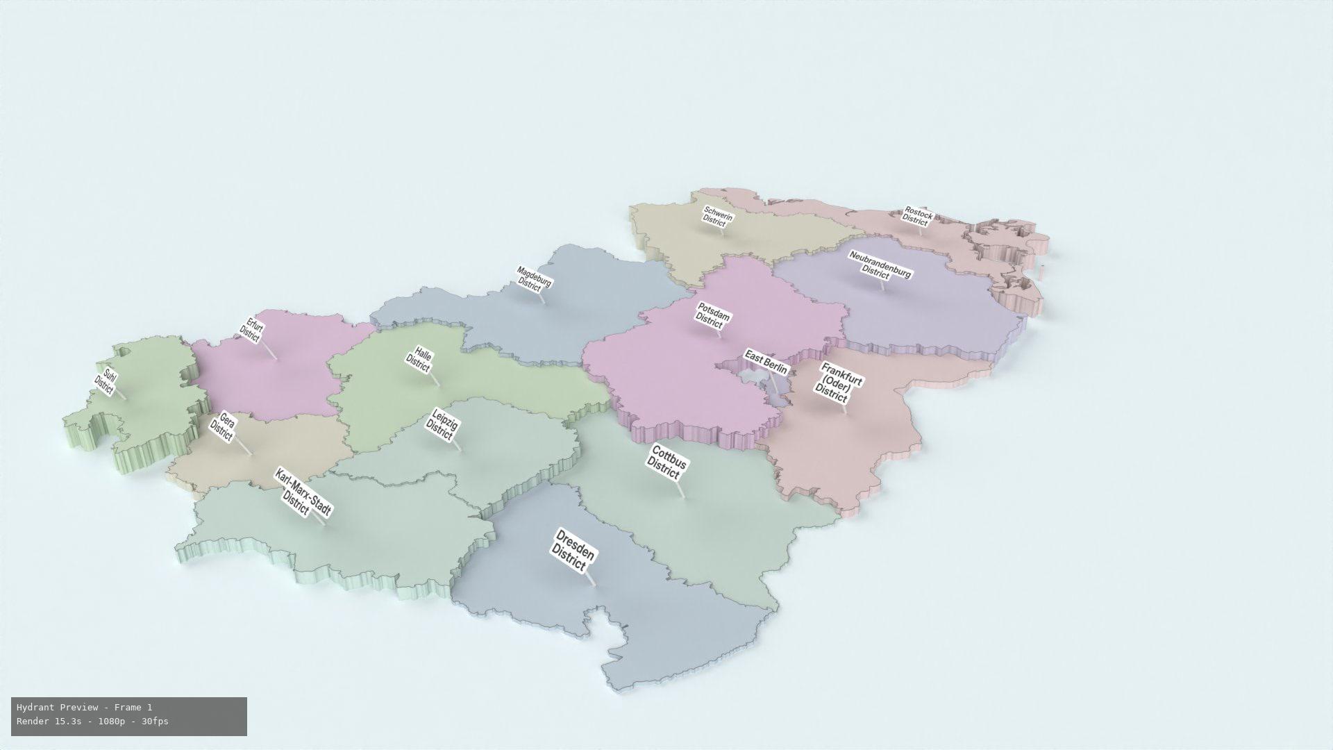
| DDR Bezirke (historical) | Bezirke (15), Kreise (218) | BKG VG-Hist |
| BRD Länder (historical) | Länder (11) | BKG VG-Hist |
The Eurostat NUTS 2021 classification for Germany.
| Level | Local Name | Count | Code Example | Name Example |
|---|---|---|---|---|
| NUTS-1 | Bundesländer | 16 | DE2 | Bayern |
| NUTS-2 | Regierungsbezirke | 38 | DE21 | Oberbayern |
| NUTS-3 | Kreise | ~400 | DE212 | München, Landeshauptstadt |
Accepted codes: NUTS codes (DE212), region names in German or English.
Preset: "Germany (Sub-national)" → Scheme: "NUTS Regions"
The 12 boroughs (Bezirke) of Berlin.
| Level | Count | Code Format | Example |
|---|---|---|---|
| Bezirk | 12 | berlin:BZK-{n} | berlin:BZK-001 — Mitte |
Bezirke include: Mitte, Friedrichshain-Kreuzberg, Pankow, Charlottenburg-Wilmersdorf, Spandau, Steglitz-Zehlendorf, Tempelhof-Schöneberg, Neukölln, Treptow-Köpenick, Marzahn-Hellersdorf, Lichtenberg, Reinickendorf.
Matching: Borough names (e.g. "Mitte", "Neukölln").
The 97 Ortsteile (localities/neighborhoods) of Berlin — named sub-district units like Prenzlauer Berg, Kreuzberg, Friedrichshain, and Charlottenburg.
| Level | Count | Code Format | Example |
|---|---|---|---|
| Ortsteil | 97 | berlin_ot:{name} | berlin_ot:Mitte — Mitte |
Matching: Ortsteil names (e.g. "Prenzlauer Berg", "Kreuzberg").
The 542 Planungsräume (LOR planning areas) — the most granular official statistical geography of Berlin, roughly corresponding to Kieze.
| Level | Count | Code Format | Example |
|---|---|---|---|
| Planungsraum | 542 | berlin_plr:{id} | berlin_plr:01100101 — Stülerstraße |
Matching: Planning area names or LOR codes.
The 7 boroughs of the Free and Hanseatic City of Hamburg.
| Level | Count | Code Format | Example |
|---|---|---|---|
| Bezirk | 7 | hamburg:BZK-{n} | hamburg:BZK-1 — Hamburg-Mitte |
Bezirke include: Hamburg-Mitte, Altona, Eimsbüttel, Hamburg-Nord, Wandsbek, Bergedorf, Harburg.
The 25 city districts (Stadtbezirke) of Munich.
| Level | Count | Code Format | Example |
|---|---|---|---|
| Stadtbezirk | 25 | munich:BZK-{nn} | munich:BZK-01 — Altstadt-Lehel |
The 9 city districts (Stadtbezirke) of Cologne.
| Level | Count | Code Format | Example |
|---|---|---|---|
| Stadtbezirk | 9 | cologne:BZK-{n} | cologne:BZK-1 — Innenstadt |
Electoral districts for the German Bundestag (federal parliament). This is a versioned scheme.
| Level | Version | Count | Code Format | Example |
|---|---|---|---|---|
| Wahlkreis | 2025 | 299 | electoral:DEU_bt_2025 | 001 — Flensburg – Schleswig |
Matching: District number (001–299) or district name.
The 15 administrative districts (Bezirke) of the German Democratic Republic (1952–1990), with an optional Kreise sub-level of 218 counties. Source: BKG VG-Hist, CC BY 4.0.
| Level | Count | Code Format | Example |
|---|---|---|---|
| Bezirk | 15 | hist:DDR-{code} | hist:DDR-LEI — Leipzig |
| Kreis | 218 | hist:DDR-KRS-{SKZ} | hist:DDR-KRS-0603 — Cottbus |
Preset: "East Germany — DDR Bezirke (1952–1990)"
The 10 states (Länder) of West Germany (Bundesrepublik Deutschland, 1949–1990) plus West Berlin. Source: BKG VG-Hist, CC BY 4.0.
| Level | Count | Code Format | Example |
|---|---|---|---|
| Land | 11 | hist:BRD-{code} | hist:BRD-BY — Bayern |
Preset: "West Germany — BRD Länder (1949–1990)"
| Scheme | Source | License | URL |
|---|---|---|---|
| NUTS Regions | Eurostat GISCO (NUTS 2024) | EC Open Data | eurostat.ec.europa.eu |
| Berlin Bezirke | Geoportal Berlin | dl-de/by-2-0 | daten.odis-berlin.de |
| Berlin Ortsteile | OpenStreetMap contributors | ODbL | openstreetmap.org |
| Berlin Planungsräume | Geoportal Berlin (WFS) | dl-de/by-2-0 | gdi.berlin.de |
| Hamburg Bezirke | OpenStreetMap contributors | ODbL | openstreetmap.org |
| Munich Stadtbezirke | OpenStreetMap contributors | ODbL | openstreetmap.org |
| Cologne Stadtbezirke | OpenStreetMap contributors | ODbL | openstreetmap.org |
| Bundestagswahlkreise | Bundeswahlleiter | — | bundeswahlleiter.de |
| DDR Bezirke + Kreise | BKG VG-Hist | CC BY 4.0 | gdz.bkg.bund.de |
| BRD Länder | BKG VG-Hist | CC BY 4.0 | gdz.bkg.bund.de |

